Navigation......................................
01.
Home
02.
General Lead Mining History
03a. Halkyn Mines: History
03b. Halkyn Mines: A few artefact photos
03c.
Halkyn Mines: info downloads
03d.
Halkyn Mines: Don Richardson - electrician
03e. Milwr Tunnel: Recent work
04.
MAP: Veins of Halkyn Mountain
05. Blaen-y-nant vein, Eryrys
06. Westminster vein, Eryrys
07. Fron Fownog Flats, Gwernaffield
08.
Pilkington's vein, Loggerheads
09.
North Henblas Mine, Milwr
10.
Deterioration of the mining record
11. Talargoch Mine
A.
Mines lighting old & new
B. Links
C. Further reading
D. Cris's Shop Window
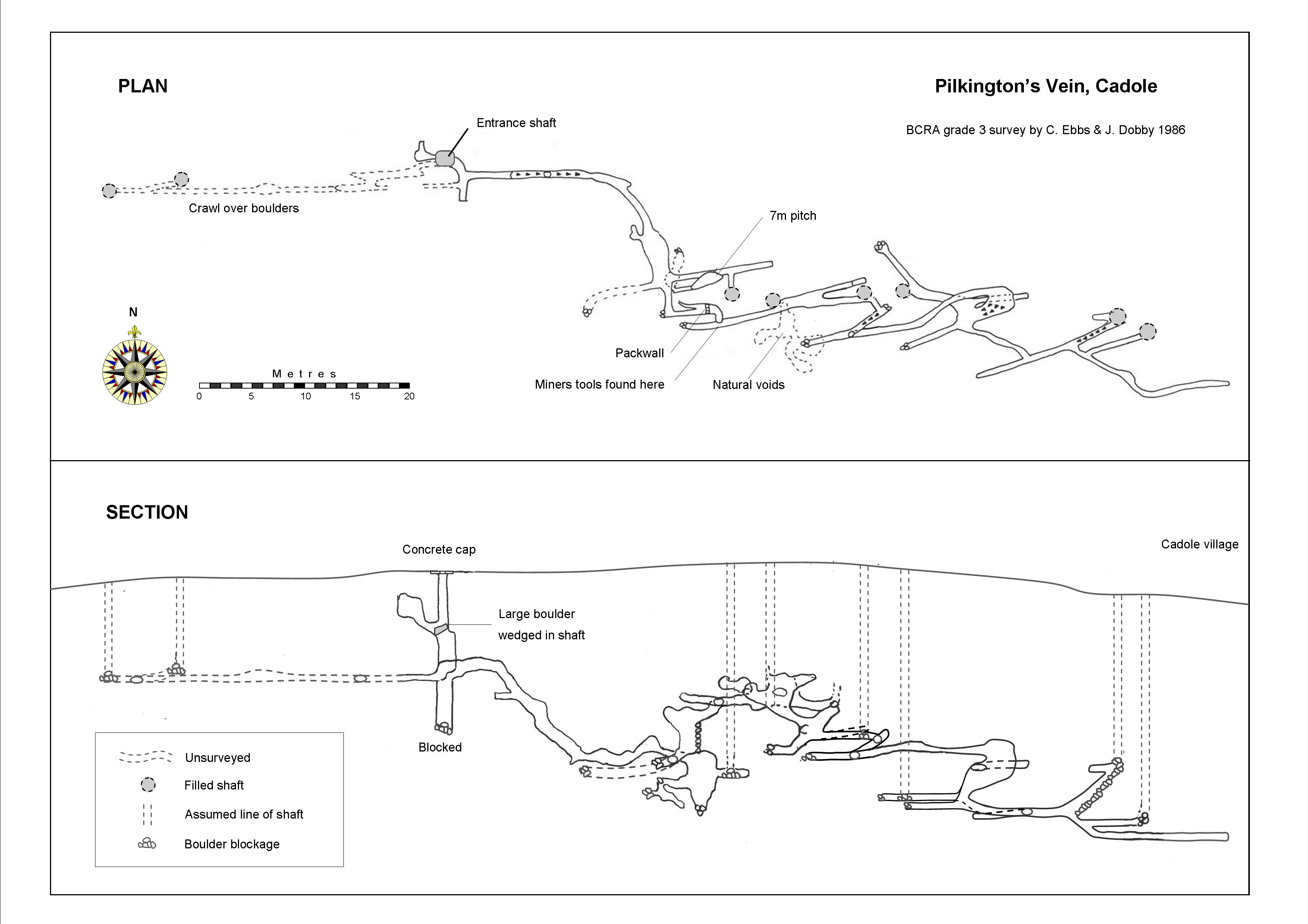
08. Pilkington's vein, Loggerheads
The above survey
is a plan and section
Click to enlarge
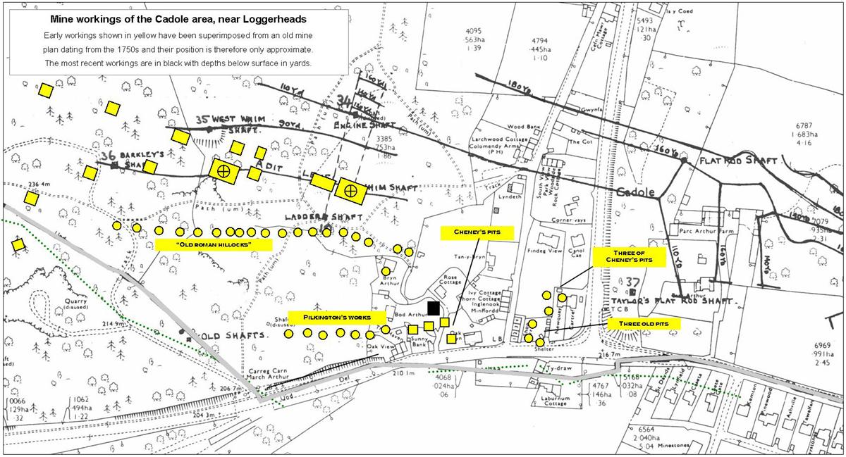
Pilkington's vein
runs through the Loggerheads woods parallel to the Mold–Ruthin road. It
is composed of a series of small branches or strings off the major
Cathole vein (see plan below) and was worked at least three hundred
years ago. A 1750s plan of the area attributes some workings to the
Romans but there is no other evidence known that might support this.
Pilkington’s was
worked from several small shafts and opencast workings. A short adit
level was driven to the vein from near the roadside boundary stone known
as Carreg Carn March Arthur.
It appears that this
vein may have been worked out by the early 1800s. An exploratory passage
was driven south at depth from Cathole vein in the 1860s, but this found
that Pilkington’s was unmineralised at the point of intersection.
Adapted from plan by Halkyn District United Mines 1986
Workings on Cathole vein are indicated by black lines.
Pilkington's vein lies closer to the bottom of the plan.
It's line is indicated by several shafts shown in yellow which have
been added by this writer, the locations of which are shown on a 1750s
area plan.
Modern exploration
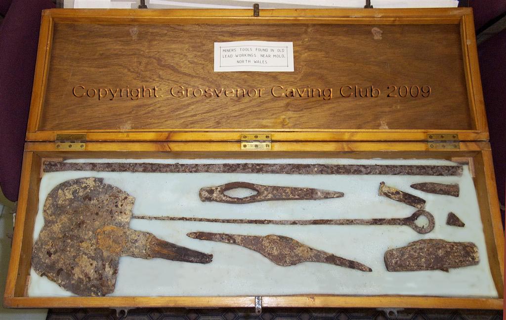
A blocked shaft was excavated in the 1980s. This revealed 1700s workings extending for 240 metres. They were explored to a maximum depth below surface of 25 metres (see survey above). At one point in the workings a set of miners tools was found comprising two picks, shovel, hammer, gad, chisel etc. One of the picks is inscribed with the initials “FW” in old English lettering. The adit near the boundary stone was entered from a nearby shallow shaft at SJ202627 in the 1970s and found to contain a set of old rails, but the passage was not fully explored at that time. The shaft and adit portal could with a little work, again reveal at least part of these interesting old workings.
Tools found in Pilkington's vein
Tools shown in a
catalogue of mining machinery of 1870,
reproduced by the
Trevithick Society and available for around £4 or so.
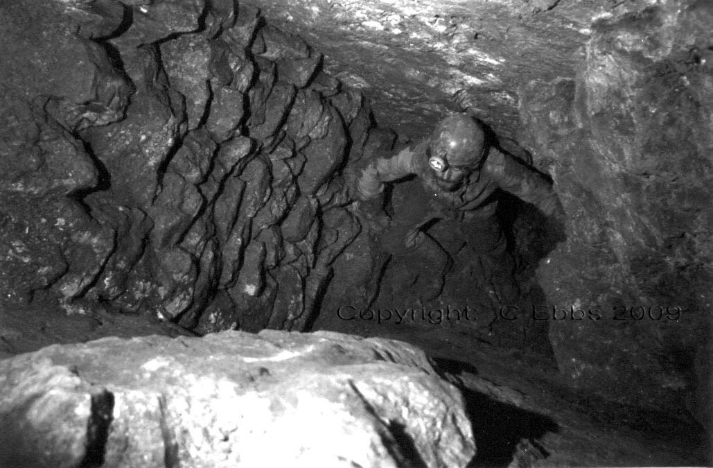
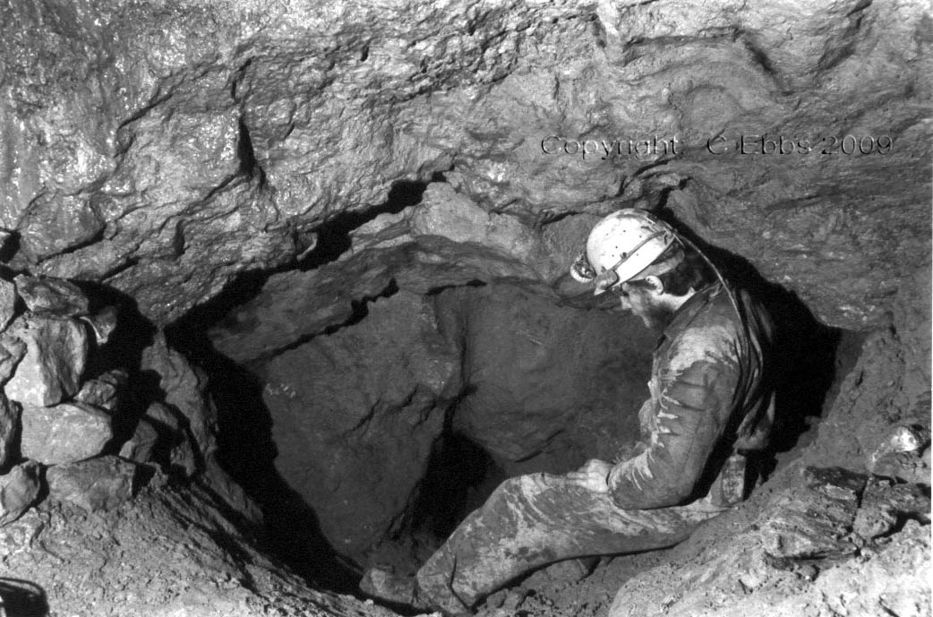
Stone pack-wall holding back deads (waste rock). The miners tools shown above were found in this area: At the top of the pack wall, the way on appeared to be upwards but was blocked by boulders. Digging here soon opened up a hole above, which entered via the floor of a passage running directly over the dig. All the tools lay together at the side of this passage, as if left by a miner expecting to return.
Pilkington's vein comprises a series of parallel poorly mineralised veins, hence the workings appear somwhat random in nature and direction. The hole above tapers to a crawl which opens beyond in a further parallel vein.
Photo: Selwyn Edwards
The three photos above show the workings as being somewhat restricted
in nature typical of the 1700s when minimal rock was removed in order
to extract ore. They may also just reflect the narrow nature of the
vein deposits.
__________________________________________________________________________________________________________________
Clwyd Powys
Archaeological Trust refer to Pilkington’s mine as being:
"Cat Hole West
(also known as Pilkington's)"
CPAT Historic
Environment Record number 18033, national grid reference SJ20206270.
Workings The Pilkington's Vein ran west from Cathole and was worked through the woodland to the west of the Cathole to Gwernaffield Road down to the River Alyn. The Old Engine Shaft remains to the south of Cefn Mawr Hall at SJ20456305 (This ref. lies too far north to be Old Engine Shaft. It is more likely to be Cefn Mawr Shaft on Deborah vein). West Whim Shaft remains overgrown at SJ2032629 (the approximate position of Old Engine Shaft). Footway and Bartlay's Shafts (should read Barkley’s Shaft) remain in this area to the south of Cefn-Mawr Hall. The area bears the earthwork scars of earlier mining activity than the Taylor period, but the area appears to have been intensely mined in the 19th century.
This description of the workings appears to
confuse Pilkington’s vein with Cathole vein. The CPAT paragraph
actually describes shafts on Cathole vein, of which Pilkington’s is a
minor off-shoot.
Around 1850 Cathole vein was connected to
Pilkington's vein by an exploratory cross-cut driven south at depth.
But at the point of intersection Pilkington's vein was found to have
been unproductive.
|